Bigler Avenue, the Clarendon Heights Avenue That Isn’t
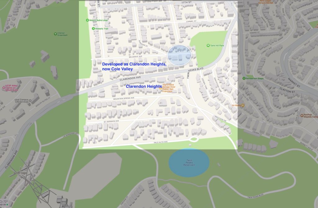
The homes on Belgrave Avenue in Cole Valley did not exist until developed as part of the Clarendon Heights neighborhood on the northern slope of Twin Peaks.
Why does Cole Street dead-endsat the base of a rocky cliff while Stanyan and Shrader dead-end at a two-block street that goes from a hike/bike trailhead at Sutro Forest to a hike/climb staircase at the bottom of Tank Hill?
One un-built Bigler Avenue is the best explanation we’ve found so far. How do we know Belgrave Avenue was developed as part of Clarendon Heights? In addition to title report docs showing when and who developed the street:
- The southernmost street of Cole Valley – Belgrave Avenue – makes sense as the northernmost street of Clarendon Heights.
- The Clarendon Heights east/west streets are: Belgrave Avenue, Clarendon Avenue, Mountain Spring Avenue, St. Germain Avenue, and Palo Alto Avenue (from north to south).
- Glenbrook Avenue runs in a northeast/southwest diagonal across the neighborhood. Clarendon Heights street names are all Avenues. That’s your tip-off that Carmel Street, the next east/west street to the north, wasn’t developed as part of Clarendon Heights.
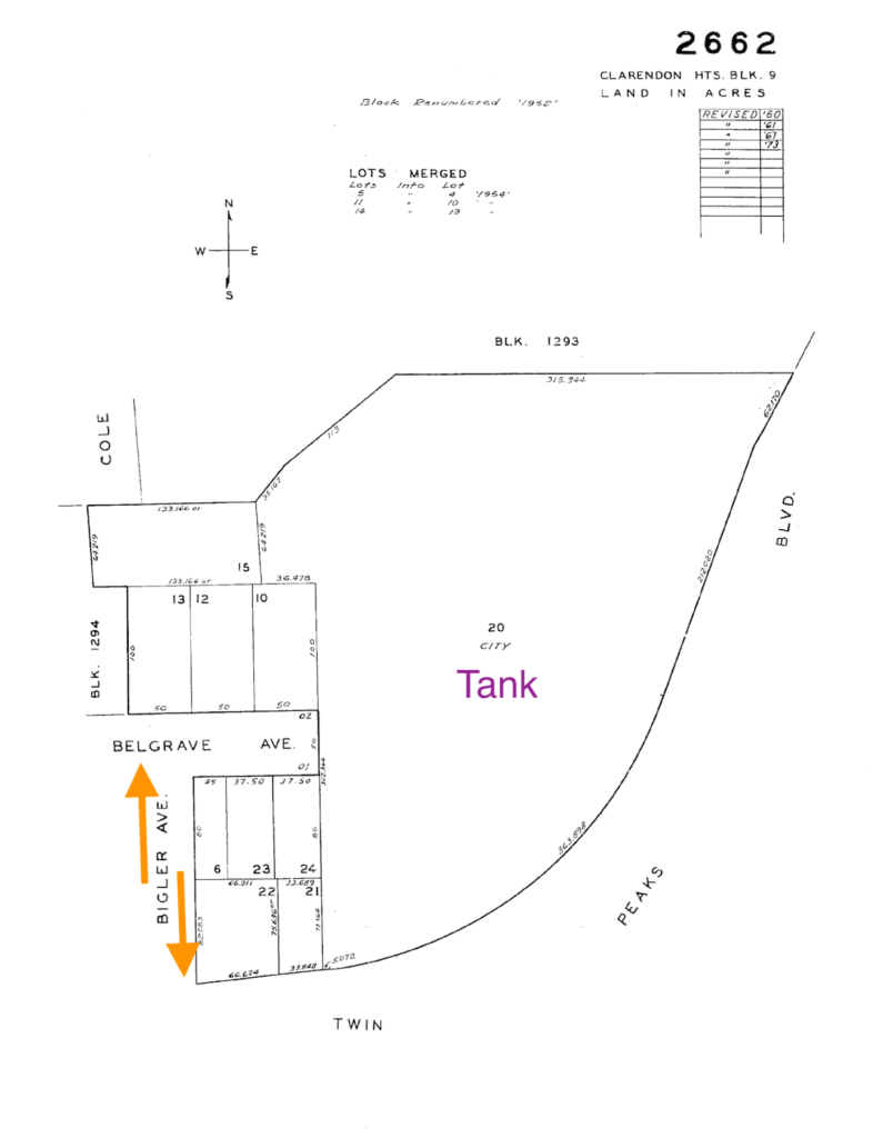
The Undeveloped Bigler Avenue
Bigler Avenue
Designed to be a north/south avenue between the homes at 25 Belgrave Avenue and 19 Belgrave Avenue, it was never developed. The southern end of Bigler Avenue would have formed a four-way intersection with Twin Peaks Blvd. and Clarendon Avenue. The northern end would have formed a T-style intersection with Belgrave Avenue.
- For whatever reason, Bigler Avenue was never built into an avenue. The land does not currently have a tax ID or APN that we can find, and while we assume it is now owned and the responsibility of the city, we don’t know and haven’t been able to track it down yet. Do you know? Any insight into the undevelopment of Bigler Avenue is much appreciated!
- Bigler Avenue currently is an undeveloped ‘greenway’ with an unmaintained and steep/rocky/uneven dirt foot path that connects Belgrave Avenue to Clarendon Avenue at Twin Peaks Blvd.
- Isn’t it Ironic? Clarendon Heights was developed when the car was king and no self-respecting upper-class American walked on foot or used public transit. Of all the SF neighborhoods to not develop an avenue for cars… and then have that undeveloped avenue become exclusively for pedestrians?
Regardless of neighborhood, one can easily argue this location is the new Broadway: the avenue with the most expensive home ($25,000,000) in the area, and with multiple homes that are now valued at over $10,000,000.
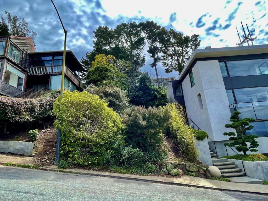
Rush Hour on Bigler Avenue at Belgrave Avenue, the one Clarendon Heights Avenue now a part of Cole Valley
Looking for an opportunity to create you own $10,000,000+ view home atop Cole Valley? Or at the base of Clarendon Heights? No matter how you classify it, the views are stunning and the Avenue is special, even for San Francisco.
40 Belgrave Avenue, recently withdrawn, was the inspiration for this blog post. Please reach out of if you are looking for a development project.
